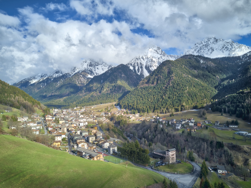
Discovering Schilpario
An itinerary with excellent panoramic value that embraces Schilpario, its hamlets, and the Vò Waterfall. The route is accessible to everyone and can be divided into sections thanks to the many opportunities to return. It can also be fully traversed by non-expert hikers willing to walk on easy trails for at least 5.45 hours.
OVERVIEW OF THE ROUTE
Starting from the Piazza of Schilpario, with the parish church dedicated to St. Anthony of Padua, go up in altitude and follow the road above the town.
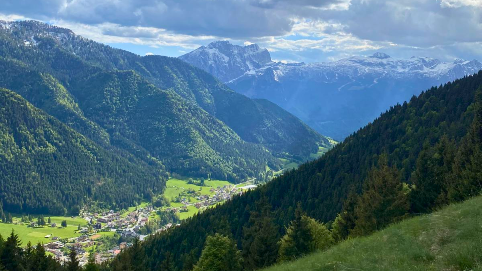
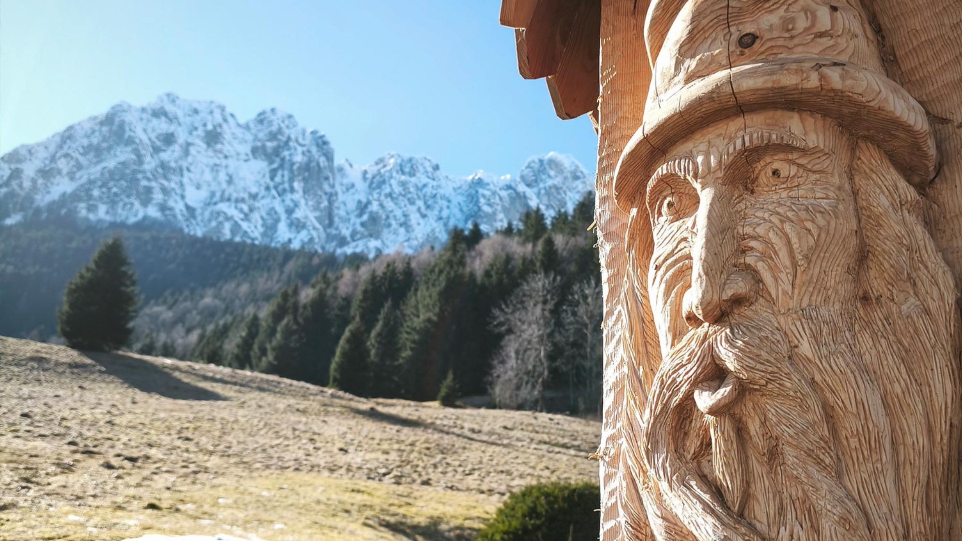
The enchanting view of Pizzo Camino will surprise you both in summer and winter. Up there, you will also find a frame made by three young residents of Schilpario using old wooden planks, decorated. Take advantage of this for a nice photo with a splendid view, and, if you like, share it on Instagram or Facebook with the hashtag #cornicealpina!
The itinerary then touches the Pista degli Abeti (a Nordic skiing track), before taking you to the village of Grumello, the oldest village of Schilpario with old, steep streets embraced by walls made of Dolomite blocks.
After passing Chalet Paradais and the Tennis/Skating Paradiso, leave the town to immerse yourself in the deep green of the woods connecting Schilpario to the hamlet of Pradella: a pleasant up-and-down route that will fill your lungs with oxygen.
Once at the Pradella hamlet, refresh yourself with a drink of fresh water at the fountain near the small church dedicated to St. Mark. You can also stop for an interesting visit to the Museum of Minerals and Fossils, with specimens from all over the world. The exhibition is inside the Hotel San Marco.
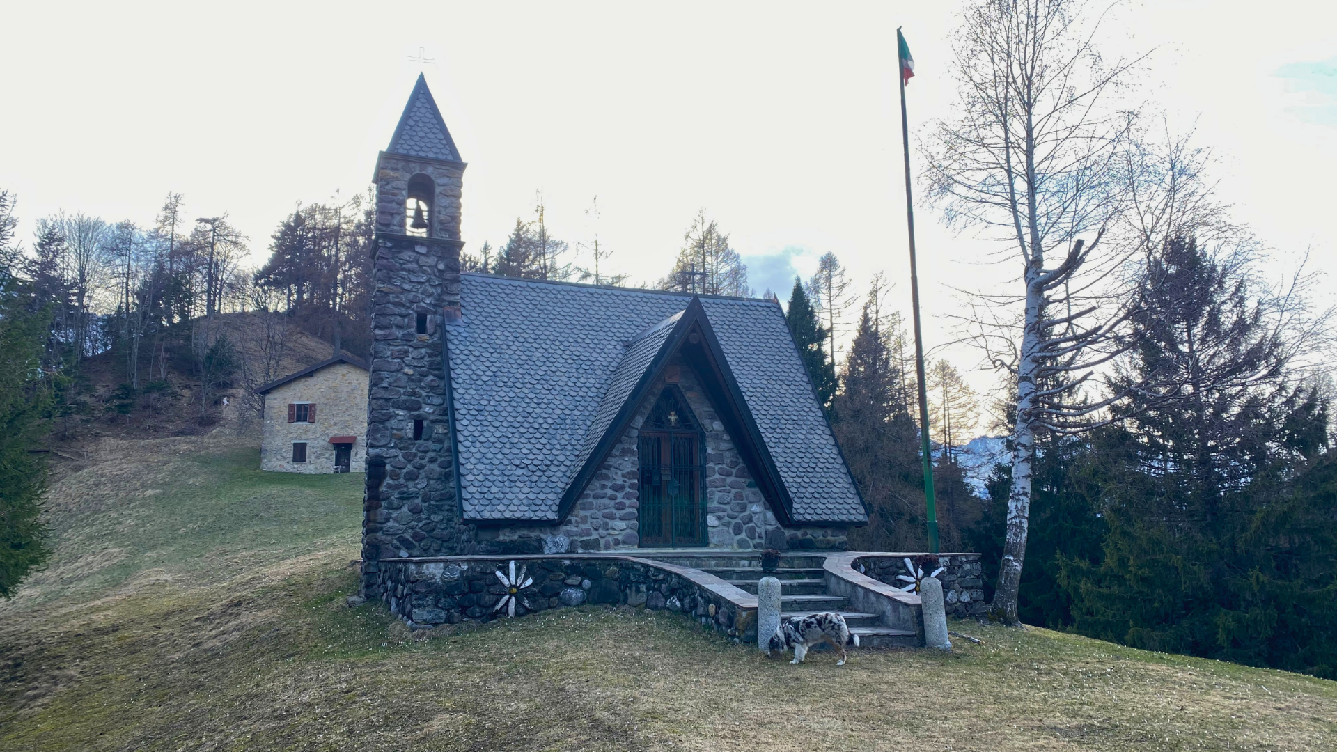
Then, as you go down towards the valley floor, you will admire the rushing waterfalls on the Dezzo Stream. If possible, cross the stream and take the easy path back up to the village of Barzesto: you will arrive in front of the church dedicated to the Most Holy Body of Christ, recently restored.
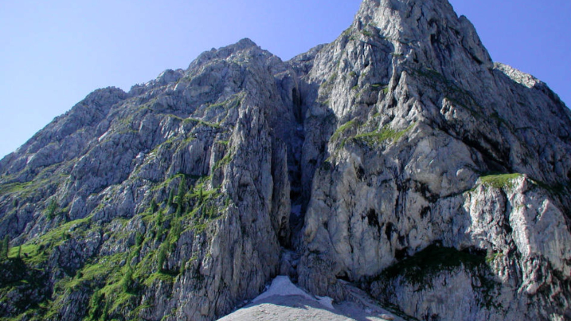
Proceeding west, once at the La Cà area, go up on the path, which will take you above the Ronco hamlet and then towards the Vò Waterfall. The route passes near a charcoal kiln area set up with a replica of a poiàt.
After crossing the wooden bridge, you can admire the old mineral roasting furnace in the area. When you reach the Vò Waterfall, let yourself be refreshed by the splashes of cool water: with a bit of luck, in the central hours of the day, you can enjoy the magnificent light reflections created by the water and the sun. If you visit the waterfall from mid-December to the end of January, you might see it completely dressed in pristine ice stalactites.
On your way back, along the comfortable mule track, follow the signs to visit the departure station of an ancient military cableway, used during World War I for building the third defensive line near Passo del Veneroccolo.
Continuing along the mule track, reach the provincial road near the Vò Bridge and ascend towards the Schilpario cemetery. With a little more effort, you can enjoy the panorama and treat yourself to another photo while sitting on the Giant Bench.
Finally, return to the starting point after an easy return.
Directions to Follow
The itinerary begins and ends at Piazza di Schilpario. From the Piazza, head towards Via Torri and immediately after the butcher, turn right into Vicolo della Fontana, proceed along the valley (usually dry), cross it and continue uphill, cross the wooden bridge, and take the dirt road, turning right uphill. Continue along the road to the panoramic frame over the village of Schilpario. Continue further until reaching a small valley (usually dry). Do not cross the valley but instead descend along the edge of the valley or next to the field near the stone embankment. At the end of the field, turn left and follow the dirt road near some terraced houses. Turn right and descend. After passing the hairpin bend on the paved road, immediately turn left and take the flat road, which becomes a dirt track after a short distance. Continue for about 400 meters. After crossing a bridge, the stony road starts to ascend. After 30-40 meters, turn right and follow the CAI 415 trail downhill. Once you reach the paved road, cross it and continue beyond the Alpine Rescue House. Proceed across the bridge on the dirt road and enter the cross-country skiing track. Head towards the town of Schilpario, passing the Sports Hall. After the hall, take the left road uphill with the stone wall. Continue along the narrow road, passing a bench, and turn left onto a narrow street.
– GRUMELLO ALTO
Once near the Grumello Alto square and the fountain, descend along the paved road of Via Paradiso, passing the Chalet (on the left) and the tennis/skating field (on the right). At the top of the sloping square, turn left and take the second road (the first on the left is a private road). Stay left and take the cemented road (CAI 423 trail). The cemented road goes around the fence of a house with a pointed roof, leaving it and turning right to stay near the fence. Take the trail and follow it. Upon reaching a small bridge over the stream, cross it and turn left, going uphill. Reach a rocky road and continue for another 150 meters. After a sharp right curve and an uphill section, the road becomes flat. Continue beyond the ruins of an old ski lift station. Continue straight along a pleasant ups and downs in the woods for about 2 km. Once at Prato della Foppa, an area shaped like a basin with a farmhouse in the middle, go around it following the comfortable trail, and when you turn right, start descending along the stony road. At the end of the road, turn left and cross the wooden bridge. Continue descending for about 100 meters. Turn left behind a large pink building (former Colonia) at the edge of the forest. The trail is not well defined as there are a couple of variations near the former Colonia but continue for several meters until the trail becomes clearly visible again. Continue straight above the village of Pradella along a pleasant ups and downs. Stay right and descend until you reach the dirt road. Turn right and continue down to the church of
– PRADELLA
Near the church, there is a fountain with excellent fresh water. Continue beyond the church towards Schilpario, passing the San Marco Hotel, consider stopping for a visit to the Museum of Fossils and Minerals. Continue beyond the hotel and the votive chapel, then near the “danger of road narrowing” sign on the left, take the downhill path. Continue until the valley floor, passing some masonry buildings on the left. Cross the bridge and ascend following the river for about 100 meters. Turn left uphill and, at the junction, after a few meters, turn left to reach the village of
– BARZESTO
In front of the church, proceed in front of the church and turn left at the junction, following the flat road until the La Cà area with an old and large building. At the end of the building, cross the Provincial road with caution and take the uphill forest road. Turn right immediately, following the trail uphill, initially in a trench of dry stone walls. Continue right and climb along the path above the village of Barzesto. After the summit, pass the farmhouse and follow a short stretch of forest road. At the curve, leave the road and keep left, taking the left trail. Continue flat to the stream (usually dry), cross it and continue for about 700 meters following the path. The trail reaches a meadow before a stream. Do not cross the stream but descend along the trail starting near the edge of the meadow (the descending trail is parallel to the meadow’s edge and outside it). Continue downhill to the forest road and turn left. Continue for 1.6 km, and once at the tree observatory (a visible structure built in the trees), proceed 50 meters uphill and at the clearing turn right. Reach the wooden bridge, cross it, and turning left, reach the
– VÒ WATERFALL
Return for a few meters on the same path and continue downhill along the new mule track until you reach the paved road. Continue until you cross the Provincial Road, turn left, and ascend to the Schilpario cemetery along the Provincial Road (a bit tedious but necessary).
In front of the cemetery, enter the small village. Keep left and take the uphill dirt road. Continue for about 300/400 meters uphill and when you reach a large angular rock on the trail, turn right onto a flat trail. Continue on the flat trail for about 200 meters, passing under the stone farmhouse, then reach the Giant Bench. Continue past the Giant Bench trail until you reach the paved road of Via Soliva at a curve. Turn right downhill and continue straight until you reach Schilpario square, the original starting point.
TECHNICAL DETAILS
Departure: Piazza di Schilpario (Piazza Cardinal Angelo Maj)
Length: 16.5 km
Minimum altitude: 1008 m slm
Minimum altitude: 1229 m slm
Total descent: 771 m
Total ascent: 771 m
Natural and panoramic value: ****
Ring route: Sì
Estimated time: 5.45 h
Recommended period: da aprile a novembre
Difficulty: Media
Possibility to shorten the route: Sì
Author’s advice: È consigliato il verso di percorrenza in senso orario.
Route information
- Fino a 1000: Fino a 1000
- Riccardo Pizio per Atiesse: Riccardo Pizio per Atiesse
Maps and Downloads