Pianezza – Diga del Gleno hiking trail
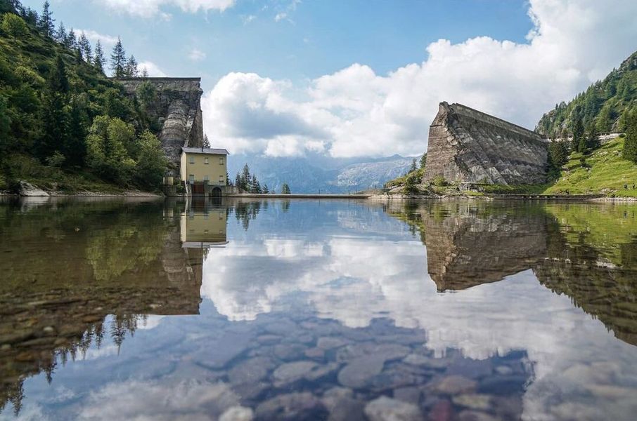
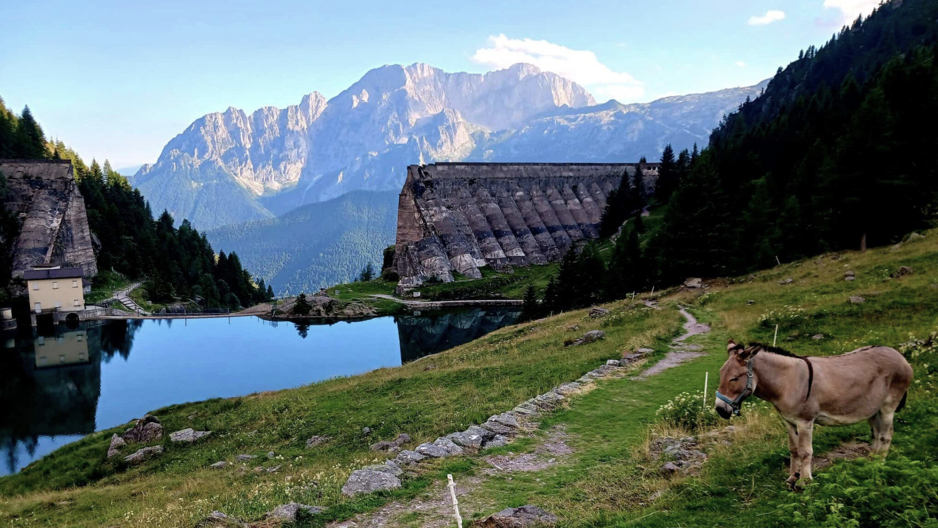
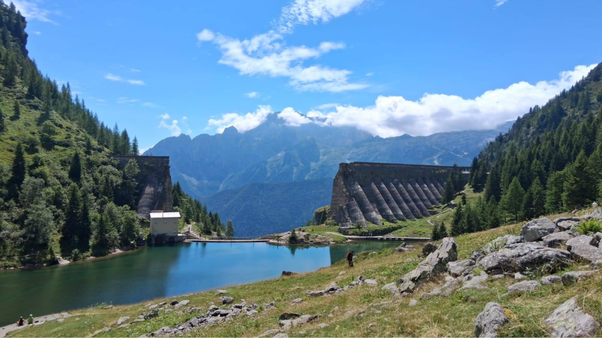
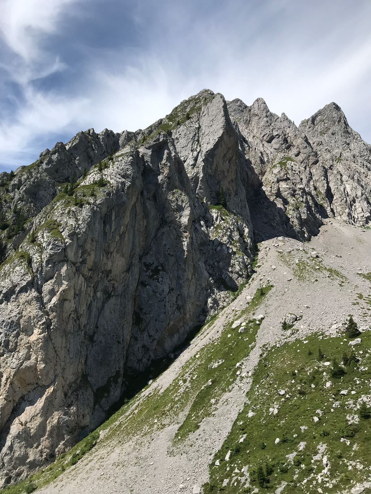
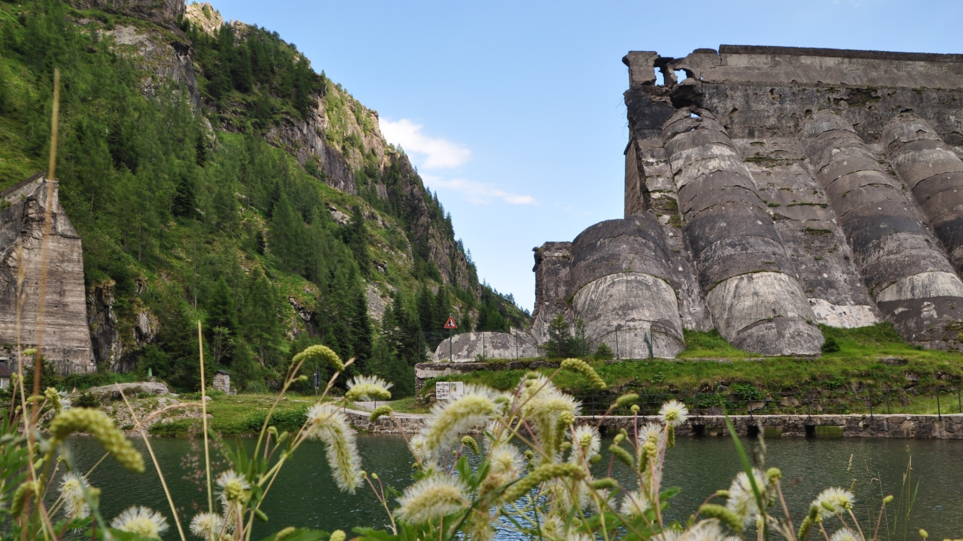
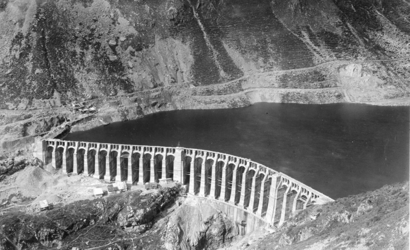
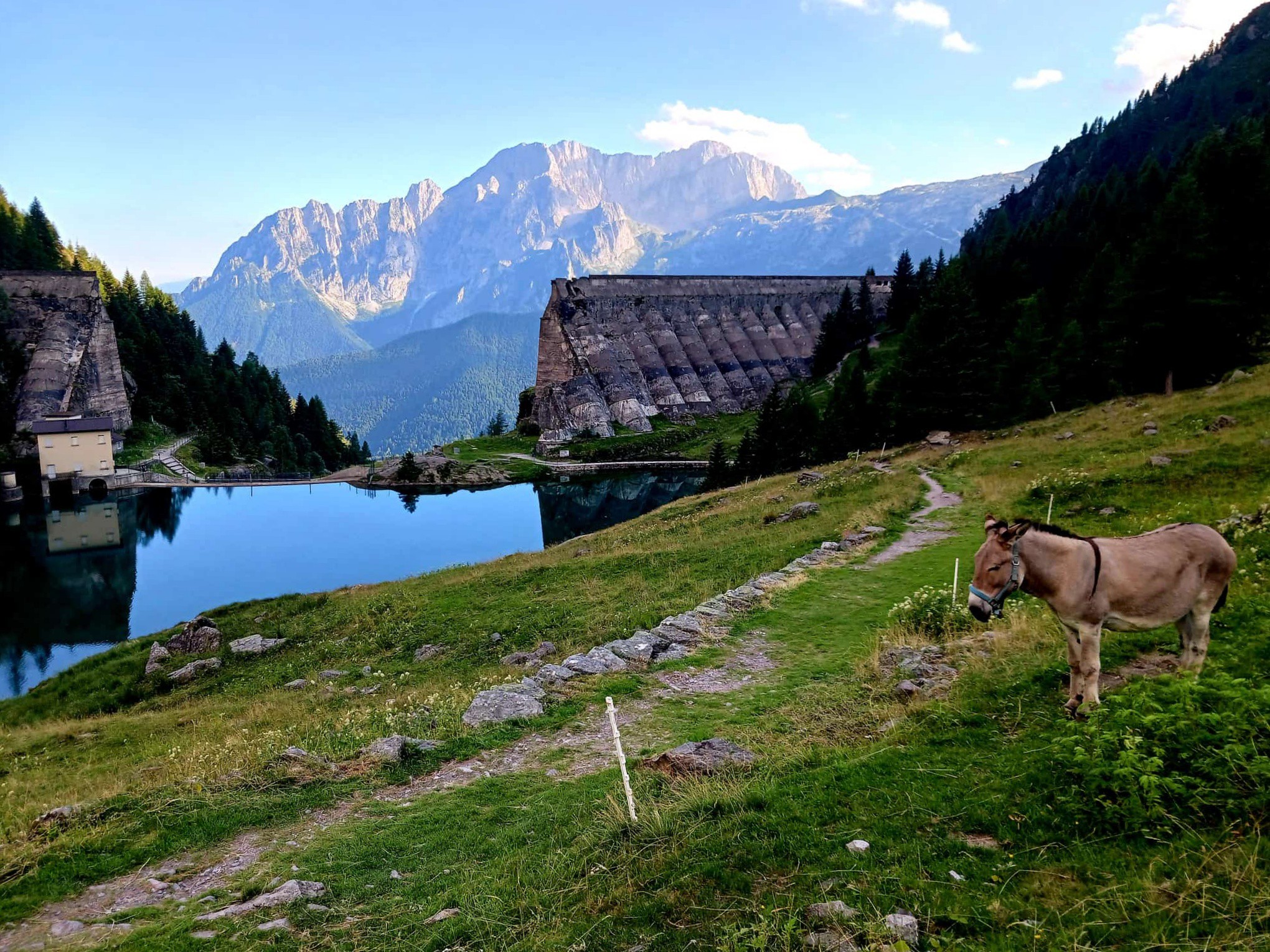
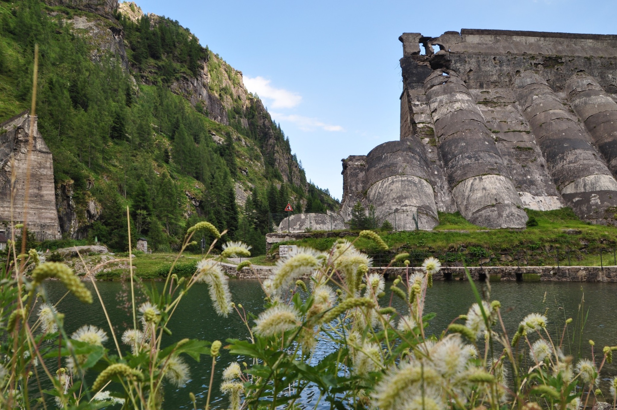
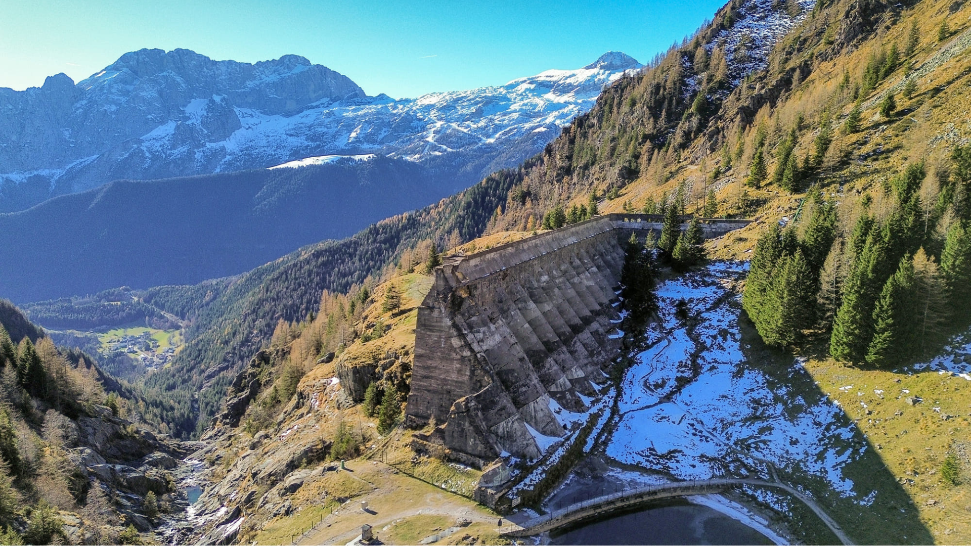
Gleno Dam is located at the foot of Mount Gleno, one of the main peaks of the Orobie Alps. This is a unique and historically rich excursion. The trek to the Gleno Dam combines the natural beauty of the Val di Scalve with the memory of the immense Gleno Dam disaster. The route to the dam from Pianezza is probably the best-known, given its moderate elevation gain. The only downside is the limited number of parking spaces during the summer months.
Route:
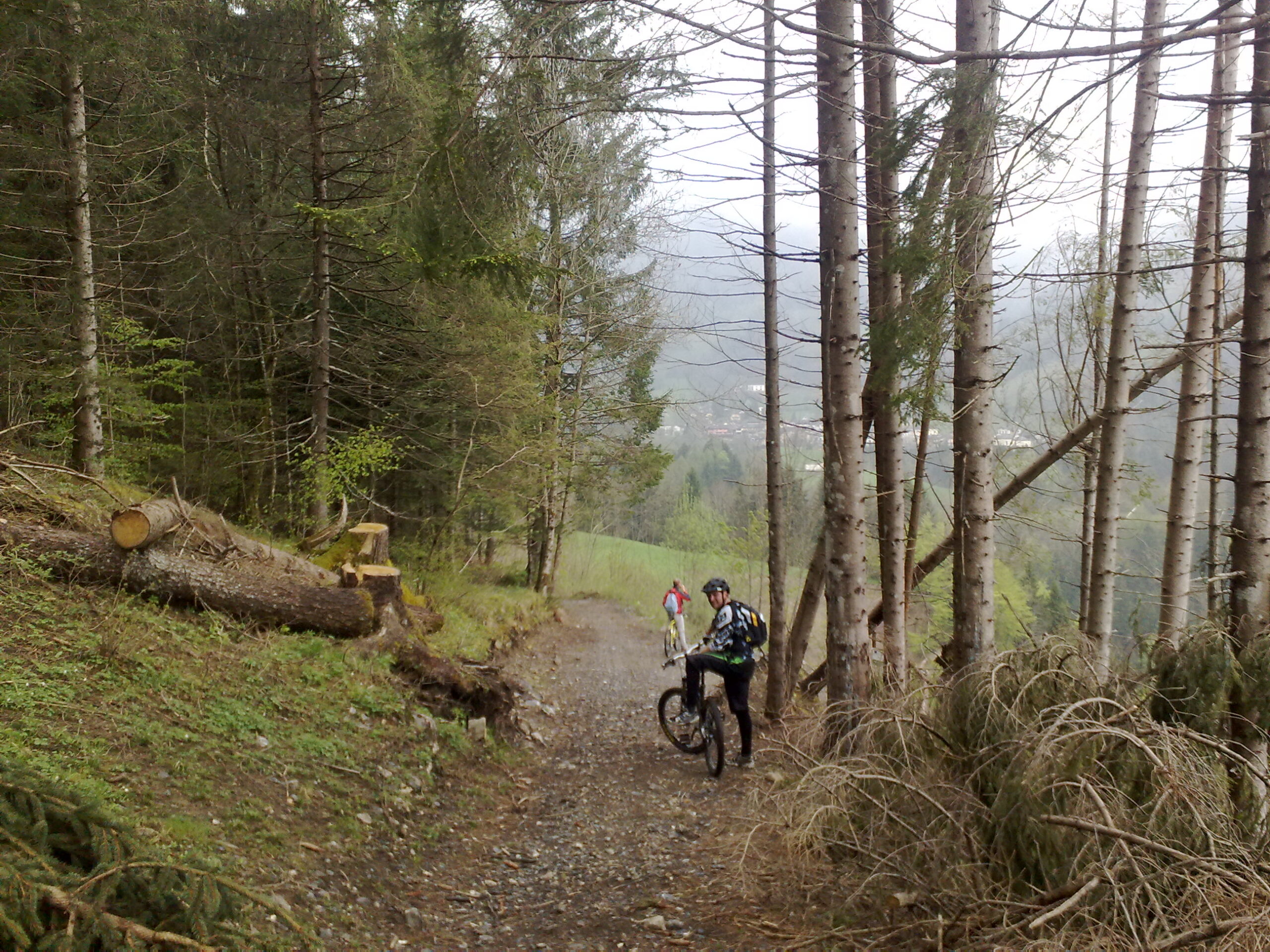
The route starts in the village of Pianezza, about 3 km from Vilminore di Scalve. During the summer, it is not possible to reach the village by car due to the scarcity of parking spaces, but a shuttle bus service is available. Once there, pass the fountain in Piazza A. Bonicelli and take the road that starts just behind the village, following trail CAI 411. The path initially crosses meadows and passes some mountain huts until it reaches a mule track. Then it continues through the forest, following the pipe of the pressurized conduit until reaching the Pagarulì area (1507 m), recognizable by a concrete structure from which the conduit starts. At this point, the trail becomes flatter and, being at the edge of the mountain, offers breathtaking views; after about 20 minutes, you reach the dam.
To return to the starting point, you can descend along the same trail you used to climb.
Download the GPX track of the route at the bottom of this page
Gleno Exhibition Space:
- In Vilminore di Scalve, since June 2018, a permanent exhibition about the Gleno Dam disaster has been open at Piazza Giustizia 1. For more information: CLICK HERE
- The online portal “Archivio Gleno” allows you to consult photographs and historical artifacts related to the Gleno Disaster: CLICK HERE
We recommend visiting this page to learn more and plan your excursion to the Gleno Dam:
Gleno Dam – Important Information
Route information
- Fino a 500: Fino a 500
- 411: 411
Maps and Downloads