Mountain bike from Colere to the Gleno dam
An interesting itinerary for visiting the famous Gleno Dam. From the Pianezza hamlet, we are forced to carry the bike for about 20 minutes, but the view and the unique charm of the ruins of the large dam reward all our efforts. The initial part of the return requires frequent ups and downs on the saddle, is less demanding but requires more attention.
Technical details
Difficulty: OC/EC
Length: 33.5 km
Time in motion: 2 h 44 min
Rideability: (80% uphill) — (80% downhill)
Recommended period: May – September
Asphalt: 50% — Dirt roads: 20% — Trail: 30%
Min altitude: 994 m — Max altitude: 1576 m
Elevation gain: Ascent 1741 m — Descent 1754 m
Push sections: YES — Bike carrying sections: YES — GPS track: YES
GPS TRACK IS ESSENTIAL
Tested by: Gian Pietro M. – Nicola T.
Rating: Good
Technical advice: Always carry caution, good manners, respect, and courtesy. Pay attention to marked deviations. Carefully evaluate weather conditions before starting.
Route
The starting point is in the town of Colere, where we leave the car in one of the parking areas at the village entrance. Follow the main asphalt road towards Vilminore di Scalve. After passing Teveno and Bueggio, continue slightly downhill on asphalt.
WATCH FOR THE NEXT TURN
Upon reaching the unmistakable San Carlo church with its blue plaster, take the dirt road on the left following the signs to Ponte del Gleno. At the Ponte Gleno equipped area, turn right and follow the trail to Pianezza. Carry the MTB for about five minutes until reaching a trail, then turn right to continue on the road.
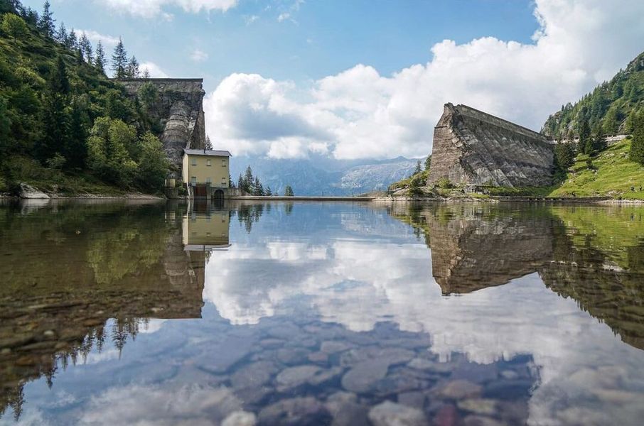
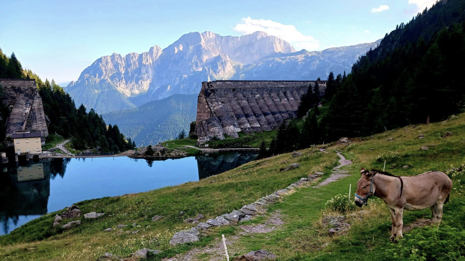
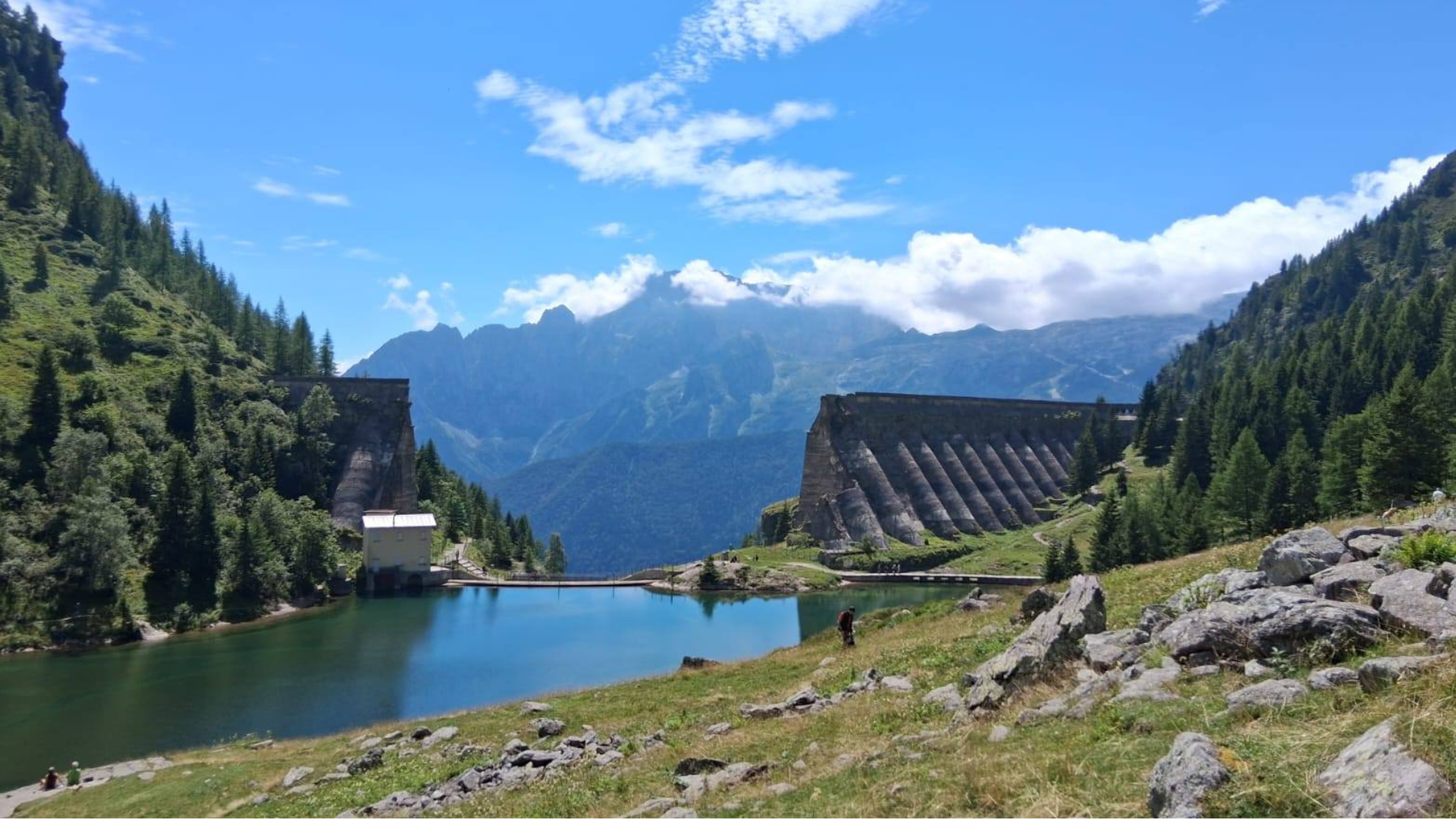
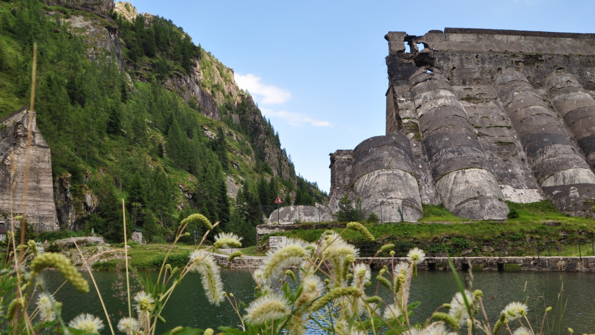
Continue uphill towards Pianezza, pass it, and follow signs for the Gleno Dam (CAI 410). The road becomes steep, then dirt and flat until the junction to the dam trail. Here, you will need to carry the MTB for twenty minutes, rewarded with stunning panoramic points along the way.

The upper trail becomes flat and rideable, allowing remounting the bike until reaching the ruins of the Gleno Dam, collapsed in 1923.

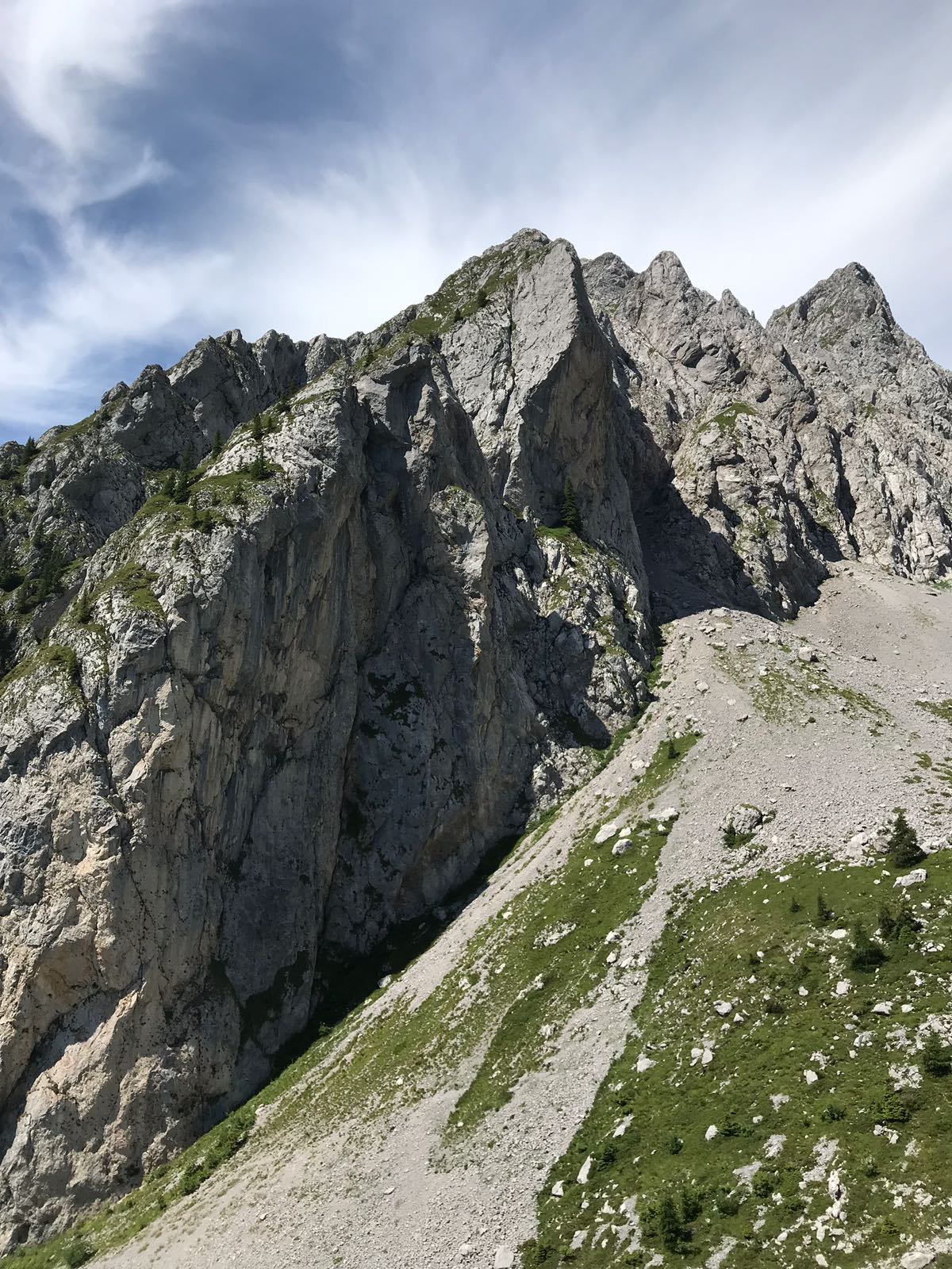
For the return, two options exist: retrace the route already traveled, or take a scenic and technical variant with rocks, iron paths, and continuous ups and downs.
From the bar hut, head towards the top of the dam and find the lightly marked trail to Bueggio. At the first junction, keep right to ascend to the paved farm road. Turn left downhill, passing farmhouses and barns, then leave the road and turn left following signs for Bueggio. Follow this steep technical trail until returning to the Ponte Gleno area.

From here, simply retrace the rest of the route back to the starting point.
Original text adapted. For more information and maps, download the printable sheet or click here (Route n. 6).
Route published in collaboration with ORANGEMTB.COM. Discover more routes at www.orangemtb.com


Route information
- Difficulty: OC / EC
- Useful months: Da maggio a settembre
- Recommended MTB: , Full, Front
- Asphalt route: 50%
- Cyclability: 80%
Maps and Downloads