Mountain bike from Schilpario to the Lakes of the valleys
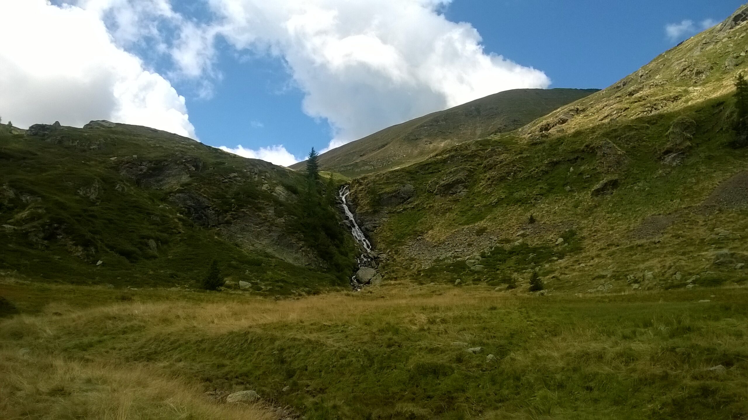
A long, peaceful and panoramic climb up to Passo del Vivione. Then, you immerse yourself in unspoiled nature, crossing small streams, lakes and dense wooded areas. The effort is quickly rewarded with breathtaking views and landscapes resembling a lunar terrain. After the Lakes of the Valli, you must INCREASE YOUR LEVEL OF ATTENTION for the return to Schilpario. The first stretch, about fifteen minutes long, forces you to carry your bike due to the rough terrain. The rest of the beautiful and technical descent on a trail requires caution and attention. A couple of pauses are recommended to maintain good brake function.
Technical details
Difficulty: BC/OC
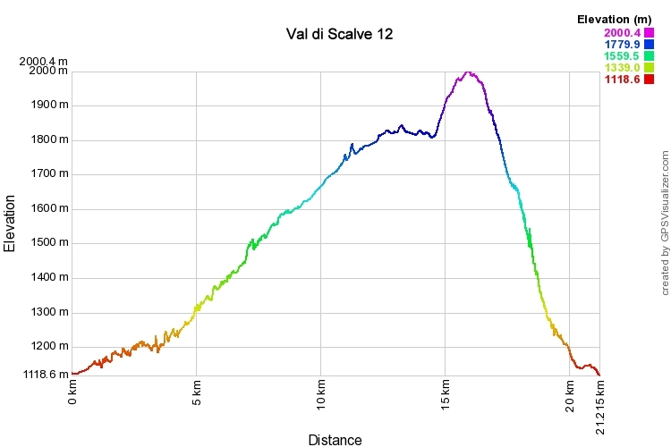
Length: 21.2 Km
Time in motion: 2 h 41 min.
Ciclability: (90% uphill) – (90% downhill)
Recommended period: May – October
Asphalt: 50% – Dirt roads: 10% – Trail: 40%
Min altitude: 1119 m – Max altitude: 2000 m
Elevation gain: Ascent: 1465 m – Descent: 1473 m
Push sections: YES – Bike carrying sections: YES – GPS track: YES
GPS TRACK IS ESSENTIAL
Tested and approved by: Gian Pietro M. – Riccardo P.
Rating: Good
Route
The starting point is at Schilpario, near the parking area at Piazzale degli Alpini. Begin this route by following the asphalt road that leads to Passo del Vivione.
WATCH FOR THE NEXT TURN.
After passing the tennis and football fields near the Alpine rescue base, leave the main road and turn right, following the slightly descending asphalt road. Before reaching the square, look to your left and take the wide dirt road uphill (the base of the cross-country ski trail). After about 200 meters, at the crossroads, take the right. At the next crossroad, turn left and continue uphill. Then, after a flat stretch, turn left again, cross a bridge, and continue uphill on an increasing slope up until you reach a bridge.
Proceed downhill, keep right, and after a flat section, turn left, then immediately right to start climbing again. Once you reach the stream, cross it, and take a straight path along the steepest section, using some vigorous pedaling to join the asphalt again (we are near the Gaffione mine).
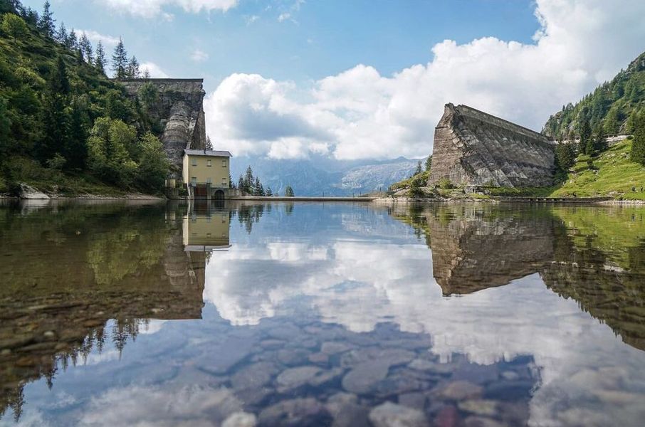
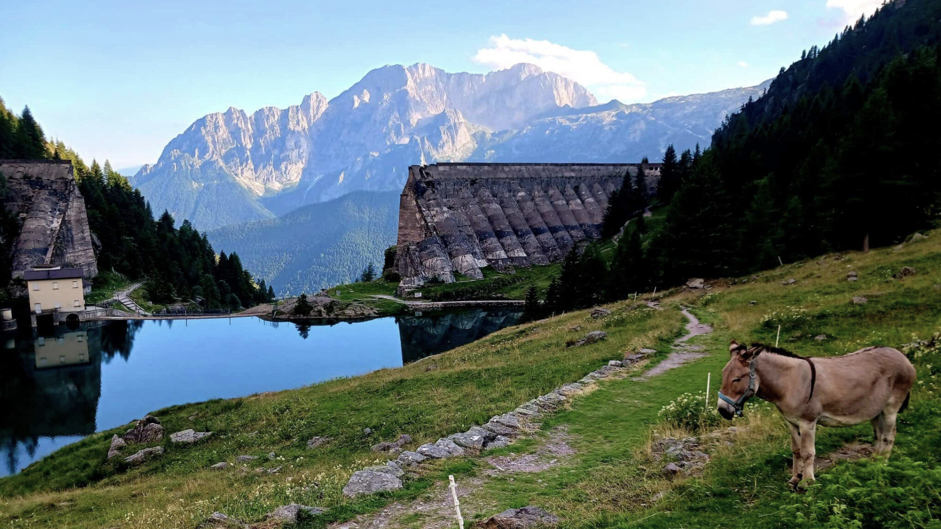
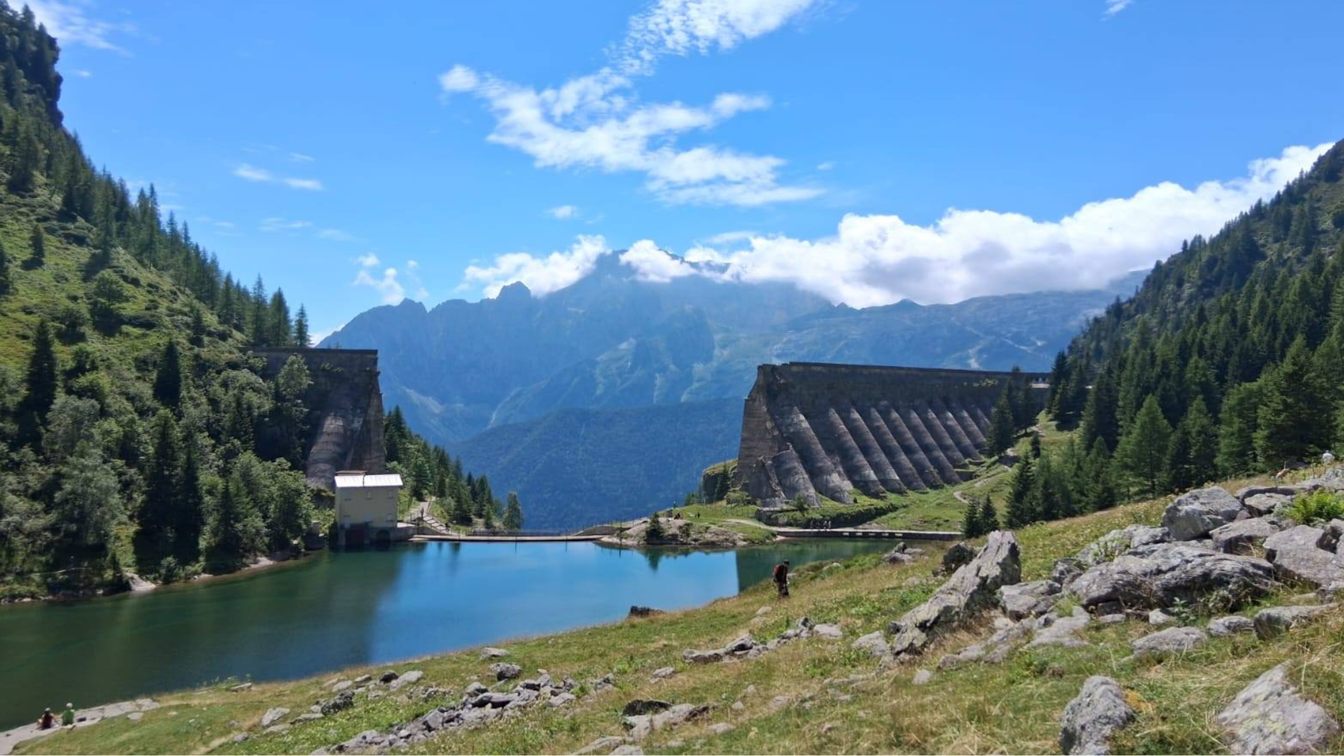
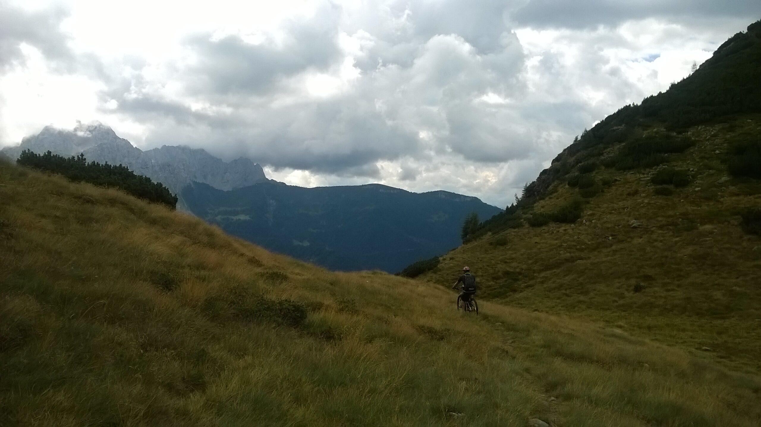
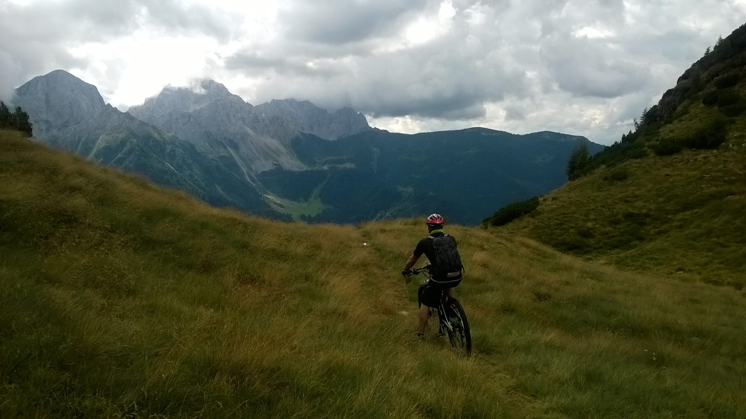
Continue right on the long but tranquil 8 km ascent until you reach Passo del Vivione. Once at the pass, after taking a commemorative photo, turn left on the road that circles the lake, following CAI trail 415 to the Lakes of the Valli.

WATCH FOR THE NEXT TURN.
For now, do not consider the CAI sign on the left, continue straight, and after crossing a stream, keep left towards the malga (a mountain hut). Pass the characteristic stone building, follow the muddy, poorly marked trail, aiming for the small wooden bridge.

WATCH FOR THE NEXT TURN.
After crossing the bridge, follow the trail that climbs to the right. This marks the beginning of the first challenging stretch that forces you, for twenty minutes, to alternate between pushing and pedaling, and at times, carrying your bike. Continuing along the trail, you will pass three small lakes, and the most demanding and exposed section of the route begins. Increase your level of attention in the first fifteen minutes with your bike on foot. In the second part, the trail becomes adrenaline-filled and ridable. The roots and slope of this beautiful technical trail will test your brakes, so taking a few breaks is recommended.
By following the CAI signs, you will return to Schilpario, right in front of the Alpine rescue hut. Cross the asphalt road at a right angle and take the dirt road over the bridge. Descend along the ski trail, maintaining the same direction and regaining altitude beside the stream. Turn right on the flat road, which becomes asphalted and will lead you back to the starting point.
Original text modified. For more information and detailed maps, you can download the printable sheet or click here (Route n. 12).
This route was published in collaboration with: ORANGEMTB
Discover many other routes on the website www.orangemtb.com


Route information
- Difficulty: BC / OC
- Useful months: From may to October
- Recommended MTB: , Full, Front
- Asphalt route: 60%
- Cyclability: 90%
Maps and Downloads