

Around Vilminore di Scalve
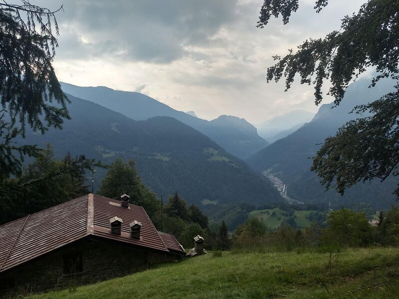
A very interesting circular itinerary that requires a minimum level of fitness, as the initial stretch takes you from the square of Vilminore — the lowest point of the route — to an altitude of 1,344 m over about 3 km.
ROUTE
The route starts and ends at Piazza Papa Giovanni XXIII, near the Vilminore di Scalve Town Hall.
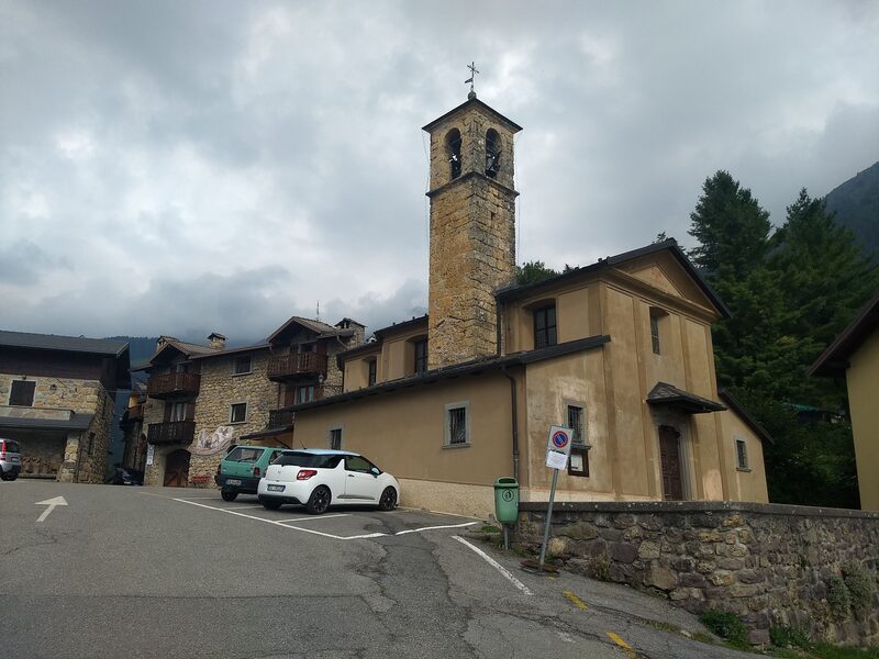
Take the uphill street next to the Bar Imperial and continue uphill, passing by Bar Sport (a characteristic building with well-preserved antique style) and the Albergo Brescia. Continue on flat terrain, passing at the base of the church’s imposing staircase; at the intersection, turn left, taking the uphill road. Pass through the stone arch and ascend to the provincial road, then turn right towards Schilpario.
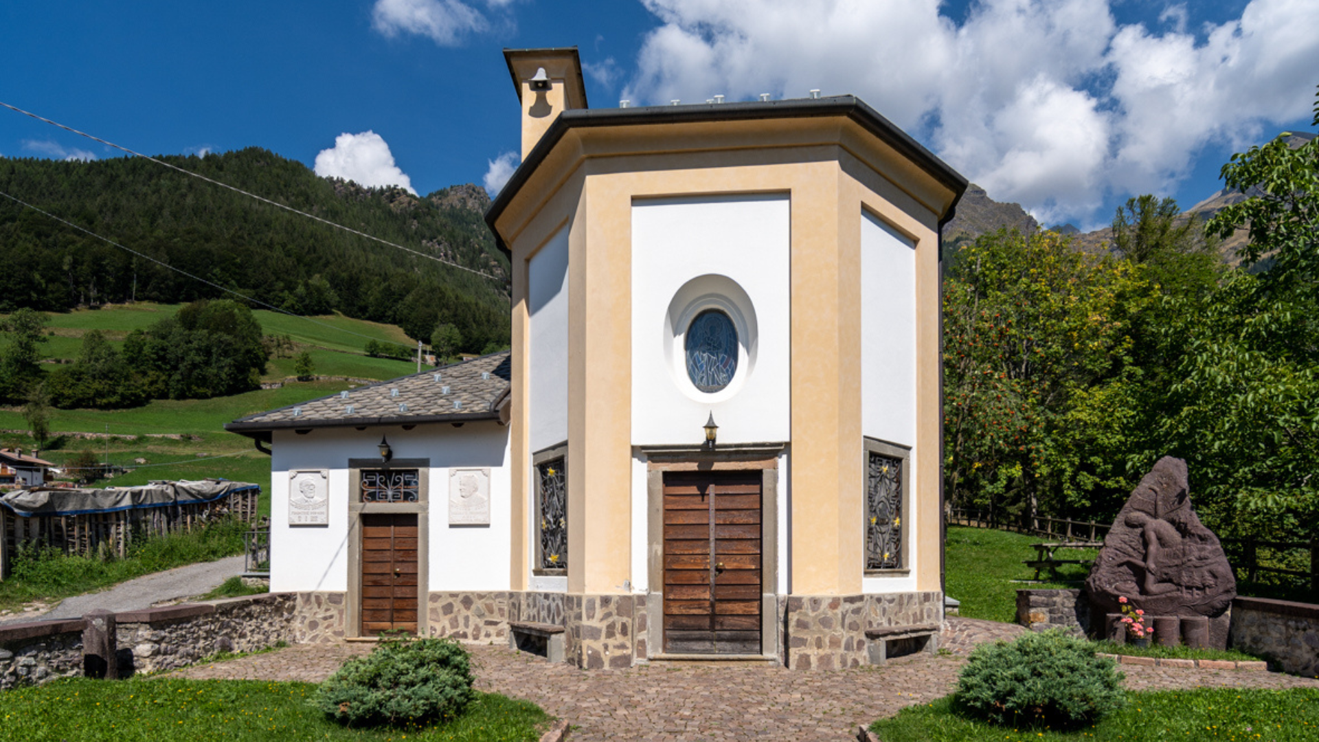
Pass a rural building on the right and continue to a second rural building on the left. Leave the provincial road and take the dirt road uphill between the rural building and a small church (the Ancient Pieve, now the Donor’s Temple).
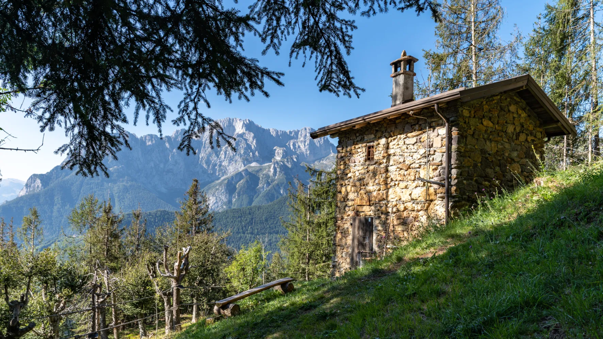
Continue along the partly paved, steep ascent. Pass the farm at the hairpin bend and a rural cluster (i Ruc) at the next bend. Continue uphill, and at the following hairpin (corresponding to a small clearing), stay on the main road (do NOT turn right onto the trail). Continue uphill on the main road; after passing the farm (roof visible on the left), proceed a few meters, leave the road, and take the trail on the left, continuing for about 400 m (pay attention here, as the trail, though easy, passes above a steep forested slope).
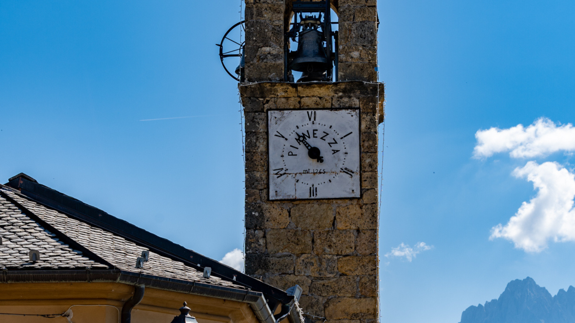
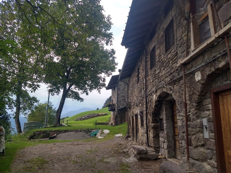
Upon reaching the fountain, continue to the stone structures resembling dolmens and menhirs. Take the road to the Cascina di Comen, a characteristic rural building excellently preserved and restored. Continue past the farm, following the trail that crosses the meadow (do not take the lower trail at the edge of the forest) and continue along the trail to the small valley and then to the village of Pianezza.
From the square of Pianezza, follow the paved road downhill, and at the first hairpin, about 200 m from the square, turn right onto the trail. Continue downhill along the trail for about 700 m until reaching the Ponte Gleno area, recognizable by some wooden sculptures and a picnic area. Keep left and continue along the wide descending road for about 1.5 km until you reach the paved road near the Church of San Carlo.
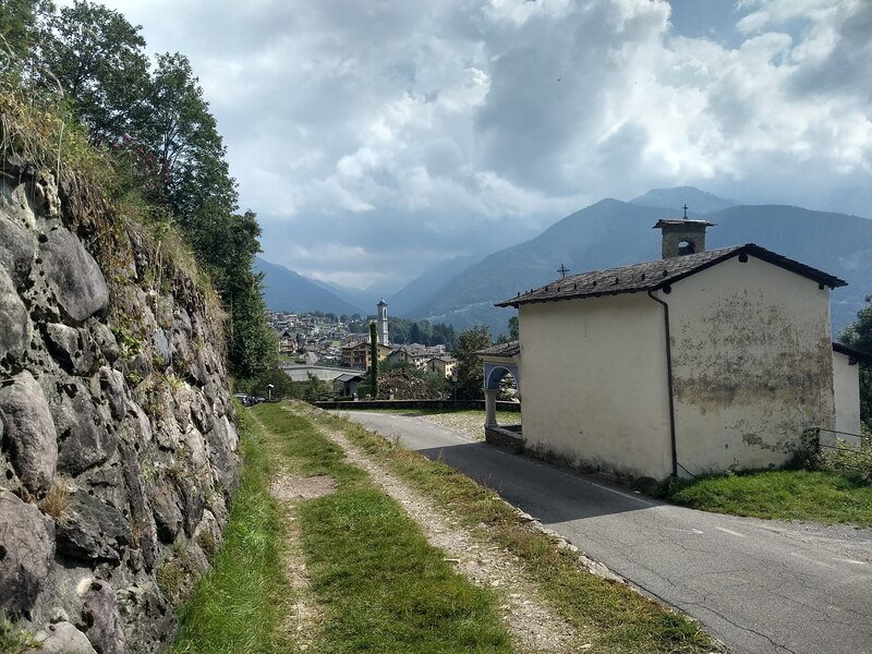
Continue on the asphalt with a slight descent to the village of Vilminore, passing the Val di Croce, from which the stones for the construction of the Vilminore bell tower were extracted.
At the first houses, leave the main paved road, turning right, descend, and at the parking lot on via Conti Albertoni, turn left. Continue until joining the hairpin on via Locatelli, descend about 100 m to reach the Piazza of Vilminore, the original starting point.


Route information
- Fino a 500: Fino a 500
- Riccardo Pizio, photos: la Via Decia : Riccardo Pizio, photos: la Via Decia