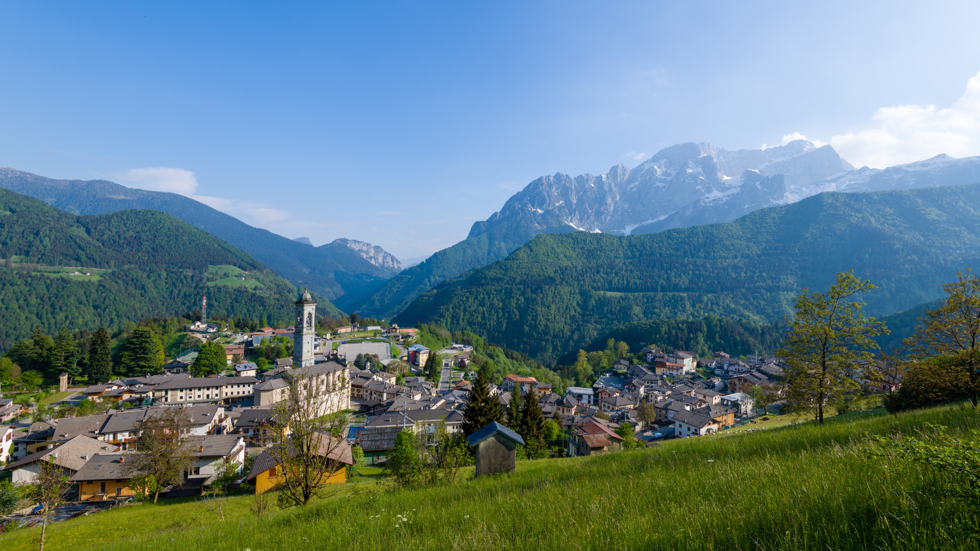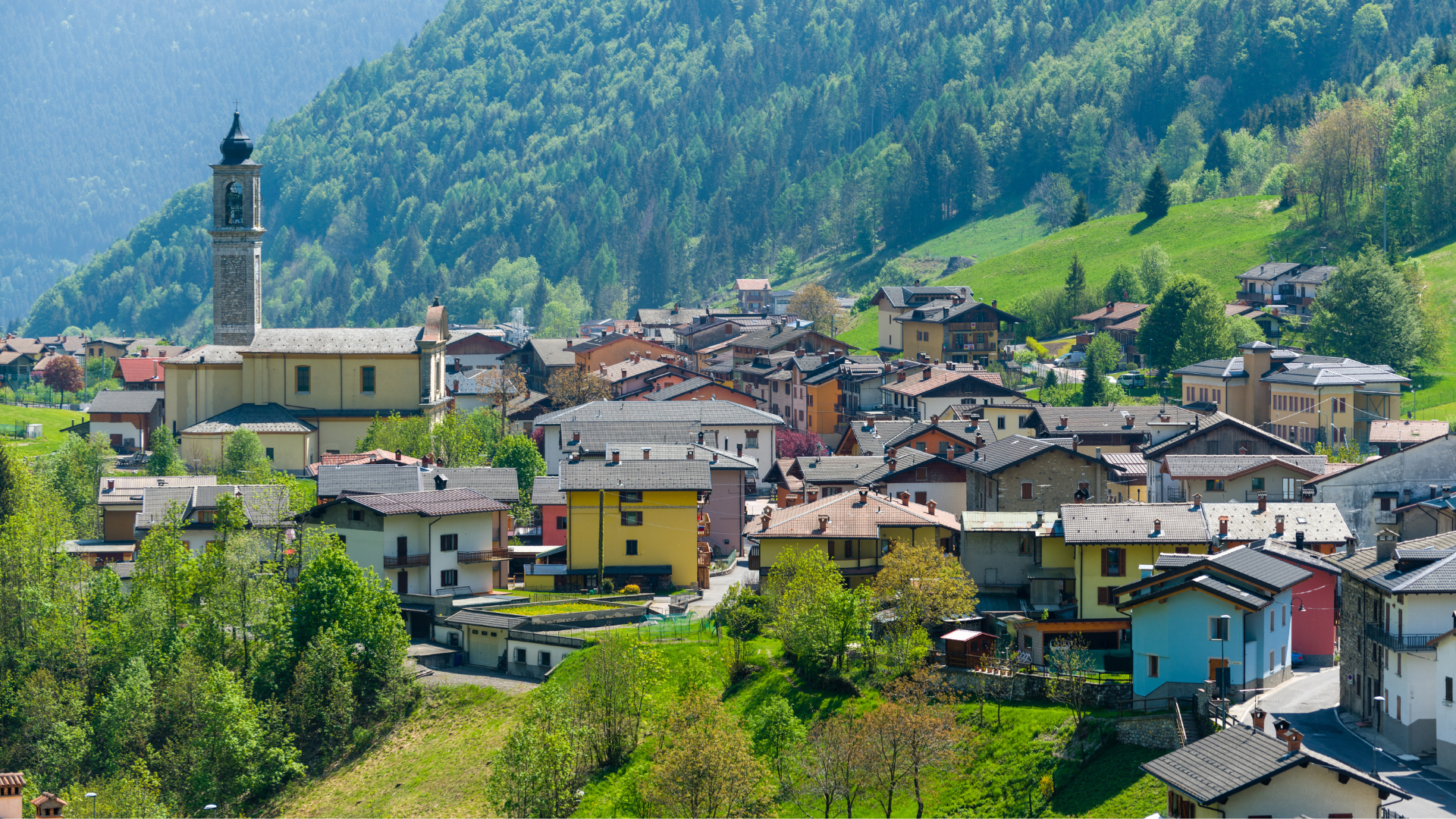
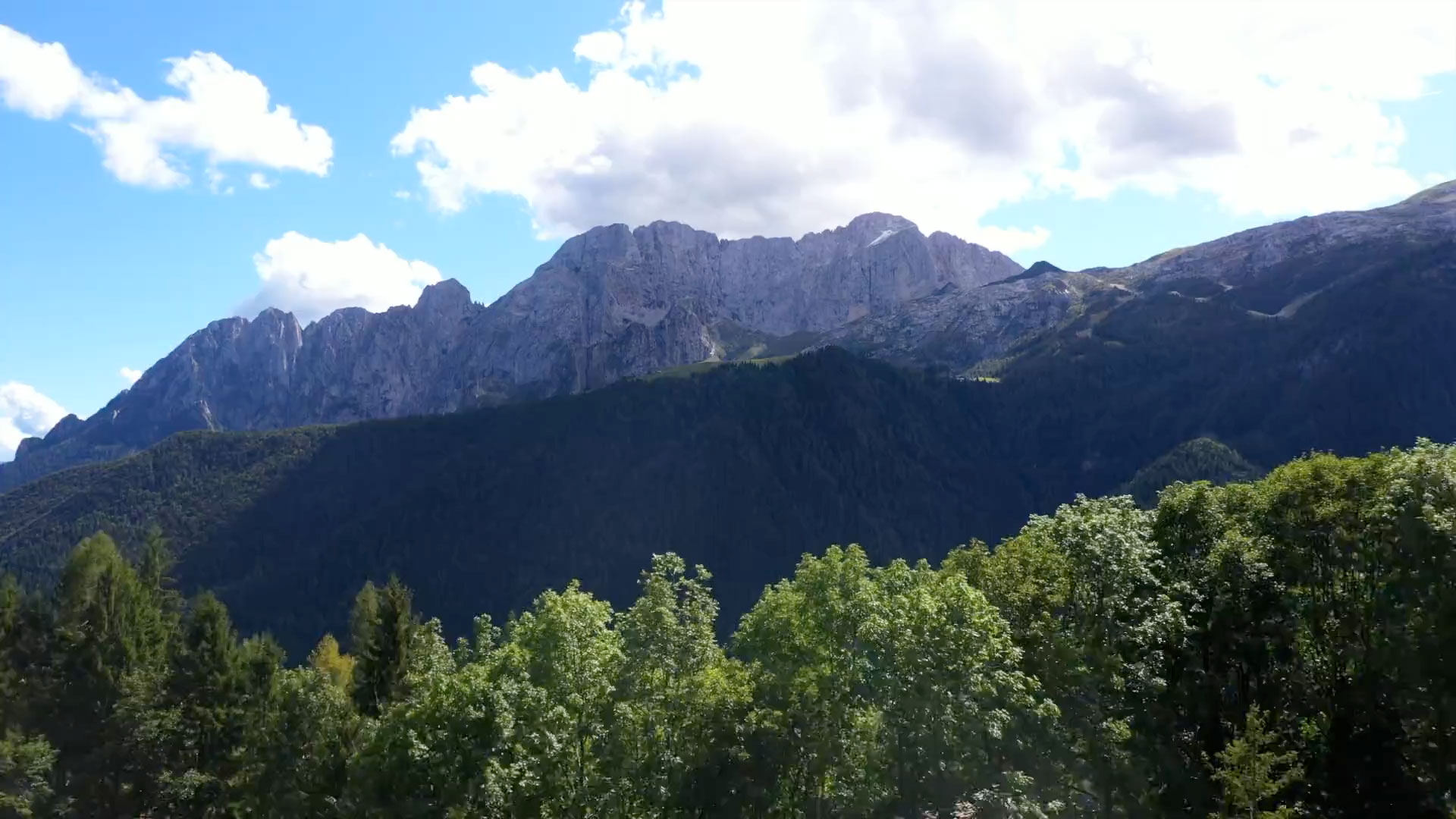
Colere
Famous for alpine skiing and ski mountaineering in winter, equally famous for trekking and climbing in summer.
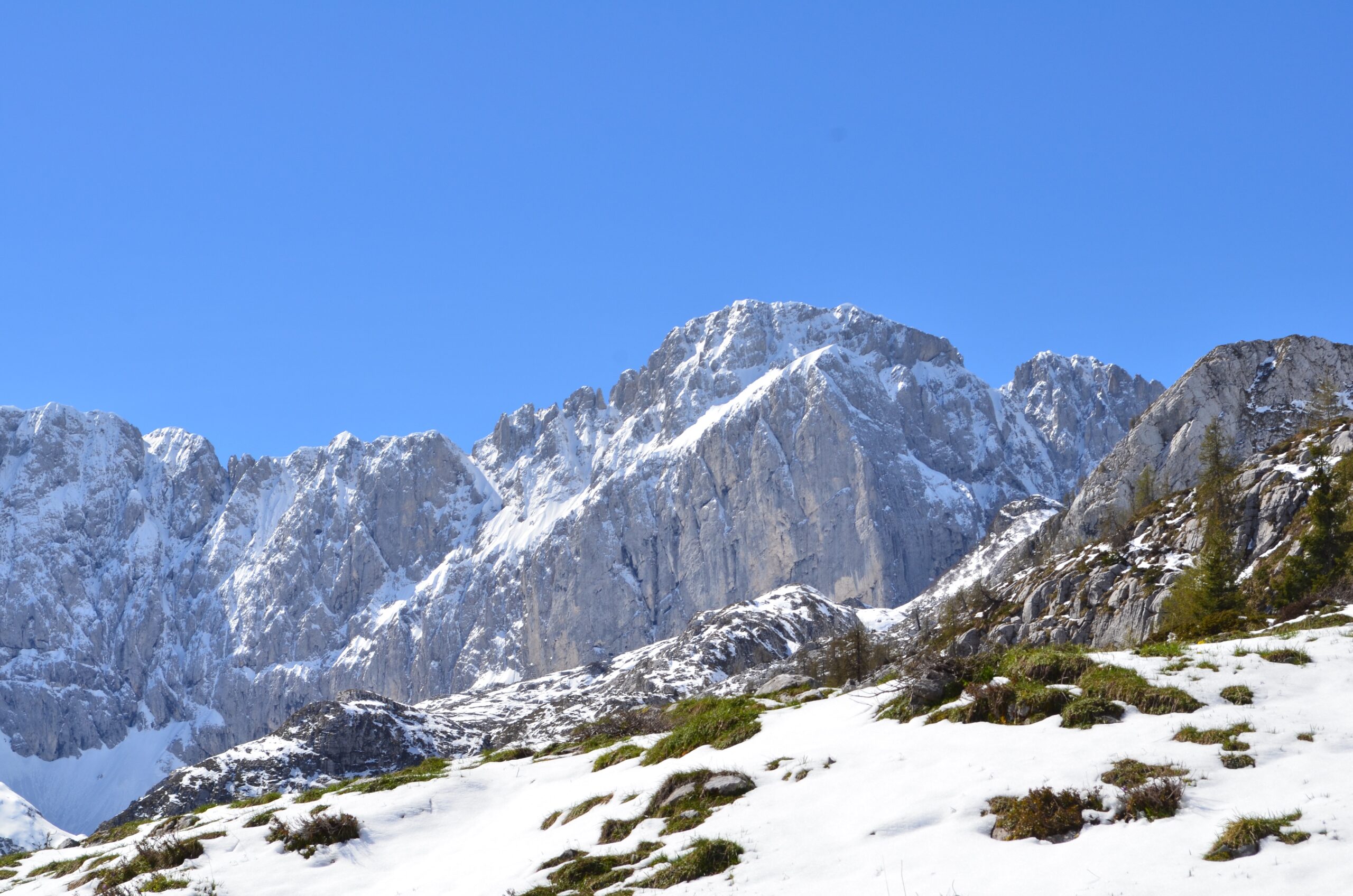
At 2,200 meters above sea level, on the slopes of the Presolana, the Queen of the Orobie Alps, Colere offers 7 km of thrilling descents – skiing here is an unforgettable experience! Thanks to its predominantly north-facing slopes, the Colere Ski Area 2200 guarantees lasting snow coverage, allowing skiers to enjoy the slopes until early spring.
During the warmer months, Colere transforms into an excellent shaded training space for climbers and trekking enthusiasts.
From the village, hikers can easily reach the Luigi Albani Refuge, which is part of the Eastern Orobie Trail. A particularly fascinating natural attraction is the Ice Cave, named for the permanent layer of ice that partially blocks its entrance throughout the year.


Colere – storia antica e moderna
Un’antica battaglia alle pendici della Presolana
According to historical traditions, Colere (specifically the Pian di Vione area) was the site of a violent battle between the forces of Charlemagne and the army of Cornelio Alano. The latter, lord of the Castle of Breno, took refuge on the slopes of Presolana to escape Charlemagne’s numerically superior troops.
Despite his efforts, Alano was defeated, and this event has given the Presolana its name: “Preso-lana” (where Alani were taken captive).
Another version suggests that the battle was between the Romans and the barbarian Alani tribe, with the mountain named after their capture – Presolana.
In 2015, under the patronage of the Comunità Montana di Scalve, the Province of Bergamo, and the Historica Colerensis Association, the Municipality of Colere produced a short film narrating the events (blending history and myth) of the battle between Charlemagne and Cornelio Alano.
Come il Comune tornò a Colere
The Municipality of Colere existed as an autonomous entity since the time of French rule. However, in December 1927, it faced the same fate as many other small Italian municipalities when the Fascist regime implemented large municipal mergers for economic, logistical, and geographical reasons. As a result, Colere and Azzone were unified under the new municipal administration of Dezzo di Scalve.
At the end of World War II, on March 5, 1946, it was only through a strong popular movement that Colere regained its independence. In a highly symbolic act, a crowd of locals reclaimed the municipal archive records, effectively restoring their town’s autonomy.
This unusual and remarkable event is told in the documentary “Il sentiero delle carte” (The Path of the Documents), produced by the Municipality of Colere in 2007, featuring the voices of those who lived through it.
If there is one key takeaway from this story, it is the deep-rooted sense of identity that has always defined the people of Colere.
IL SENTIERO DELLE CARTE: il giorno che il Comune ritornò a Colere – Davide Bassanesi
foto di Giovanni Marchesi